Thunderstorms are expected to move through the D.C. region late Thursday, bringing gusty winds and possible flooding overnight.
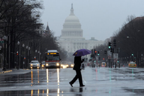
Most of the D.C. area is experiencing showers Thursday evening, with the severe weather expected to arrive later on.
“It’s going to be a noisy night for us with the thunder, some of the lightning that you’ll see even in the distance and some pockets of heavy to moderate rain,” said 7News First Alert Chief Meteorologist Veronica Johnson.
Winds could reach up to 30 mph during the scattered showers and storms overnight with temperatures in the mid 50s. Johnson said an isolated tornado is possible, especially east of Interstate 81 and west of D.C.
The heaviest showers and storms are expected to last from 9 p.m. to 3 a.m.
“After about 9 or 10 o’clock, watch out for the possibility of a squall line to develop across the western suburbs and then sweep across the area,” said WTOP Meteorologist Mike Stinneford.
Most storms are expected to wrap up after midnight.
The National Weather Service is warning that coastal areas could flood between now and Friday evening, including shorelines in D.C., Alexandria, Virginia, and Anne Arundel County, Maryland.
The Weather Prediction Center has the area as a low category 1 risk for storms and a “slight” risk for flooding, especially around the Southwest Waterfront and Hains Point Loop Road, with the heaviest rain expected overnight.
If you need to travel during these storms, take necessary precautions for flooding and allow extra travel time as some roads may be closed.
Some passing showers could move through on Friday and it will be windy and cooler.
Fortunately, these stormy conditions won’t last for long.
Heading into the weekend, you can expect to see mostly sunshine. Saturday will be breezy with highs in the 60s, while Sunday’s highs will near 80 with lighter winds, making it the perfect time to get outside.
- Listen to WTOP online and on the radio at 103.5 FM or 107.7 FM.
- Current traffic conditions
- Weather forecast
- Closings and Delays
- Sign up for WTOP alerts
Forecast
THURSDAY NIGHT: Scattered showers, storms. Pockets of moderate rain, fog. Lows: 50s. Winds: Southeast 10-15, Gusts to 25 mph.
FRIDAY: Lingering morning showers. Breezy. Highs: 60s. Winds: Southwest 10-15, Gusts 25 mph.
SATURDAY: Partly to mostly sunny, windy. Highs: around 65. Winds: West 10-20, gusts to 30 mph.
SUNDAY: Mostly sunny. Highs: 75-80. Winds: Southwest 10-15 mph.
Current weather
Get breaking news and daily headlines delivered to your email inbox by signing up here.
© 2024 WTOP. All Rights Reserved. This website is not intended for users located within the European Economic Area.